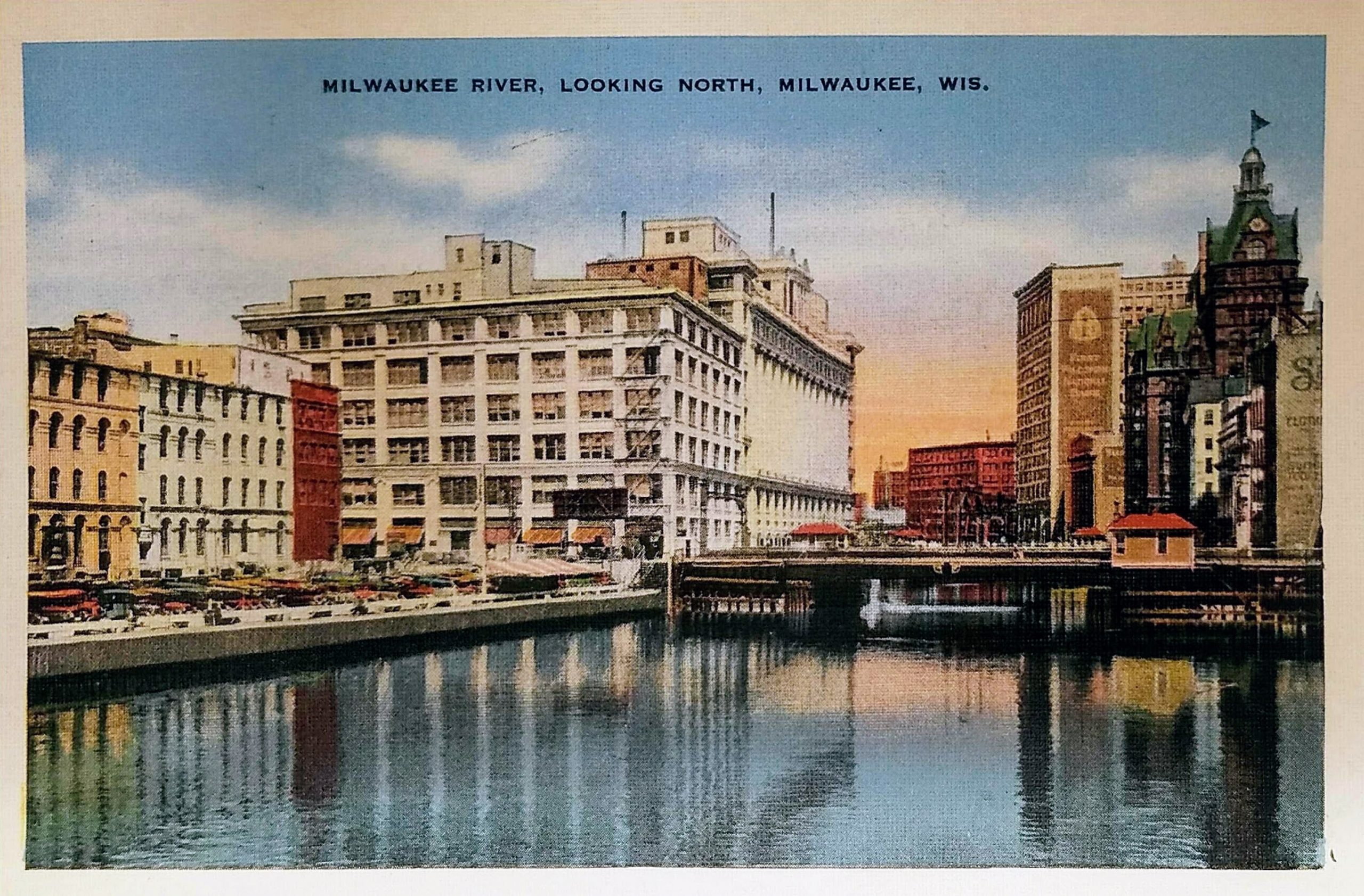
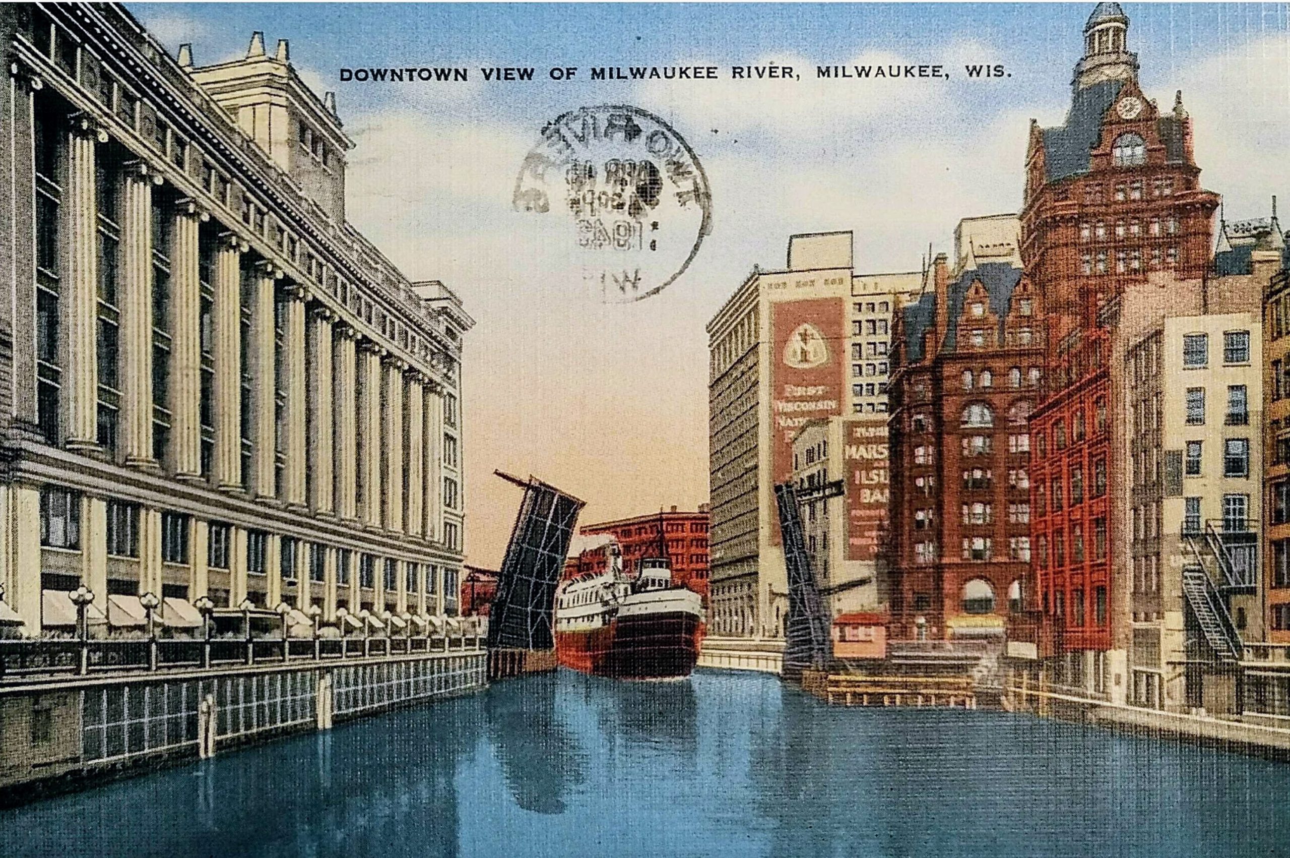
These two postcards show the view of the Milwaukee River from about a block apart. The postcard on top was postmarked in 1936, and the view is north from the east side of the river on Clybourn Street. The second postcard is postmarked 1948, and it shows the view north from Michigan Ave.
On the left side of the river is the old Gimbels Department Store. This location opened in 1887, but this shot is of the building after 1923 when Gimbels tore down their building and rebuilt an eight-story structure. The building currently houses the American Society of Quality and a Residence Inn.
The tower on the right is the old Pabst Building which was built in 1892 and demolished in 1981. It was Milwaukee’s first skyscraper. That site is where the 100 East Wisconsin Building now stands, on the northwest corner of Wisconsin and Water Streets.
Just beyond that, with a tall sign on the side, is the First Wisconsin National Bank building. The bank remained there until it moved to its new 42-story tower on East Wisconsin Ave in 1973. This building, now known as the CityCenter, still stands on the southwest corner of Water and Mason Streets
The open lot on the left of the first postcard is the site of the Riverside Building, an office building perched awkwardly atop a parking garage. That building won’t be built for three decades at the time this shot was taken. In 2019, the building was redesigned for Rexnord.
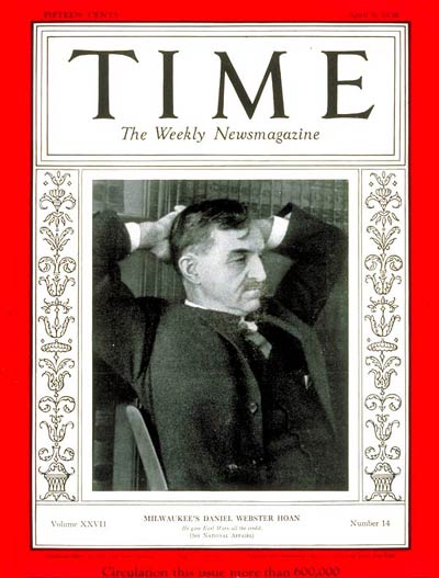
In 1936, when the first postcard is dated, Mayor Dan Hoan appeared on the cover of Time Magazine. The magazine called Hoan “one of the nation’s ablest public servants, and, under him, Milwaukee has become perhaps the best-governed city in the U.S.” He was a socialist who’d been in office for 20 years. Milwaukee had managed to avoid the worst of the depression until 1932, and under Hoan, the city launched a number of work relief programs, built libraries and parks, and helped Milwaukee through the worst of the era.
If you study Milwaukee’s history and architecture, it’s easy to see the impact of the Great Depression and WWII in the 1930s and 1940s. While dozens of buildings were added to downtown in the first few decades of the 20th Century, relatively few were built from 1935 to 1950. Building picked up again in the late-1950s and exploded in the 1960s
Sources:
https://www.wisconsinhistory.org/Records/Property/HI16193
https://collections.lib.uwm.edu/digital/collection/mkenh/id/312/
http://www.wisconsinhistoricalmarkers.com/2015/09/historic-milwaukee-east-wisconsin-avenue.html
https://urbanmilwaukee.com/2019/09/13/friday-photos-rexnord-will-occupy-downtown-buildings/
http://content.time.com/time/covers/0,16641,19360406,00.html
Identifier:
First postcard: PLUS Code: 23PR+F4 Milwaukee, Wisconsin
Second Postcard: PLUS Code: 23PR+X2 Milwaukee, Wisconsin
First postcard: Approximate Google Street View Today: https://goo.gl/maps/uKfVTC1o78Rne6Jn6
Second postcard: Approximate Google Street View Today: https://goo.gl/maps/NMhcKJtdsUmsuEL78


